Old railway sign
Introduction
The photograph on this page of Old railway sign by Marathon as part of the Geograph project.
The Geograph project started in 2005 with the aim of publishing, organising and preserving representative images for every square kilometre of Great Britain, Ireland and the Isle of Man.

There are currently over 7.5m images from over 14,400 individuals and you can help contribute to the project by visiting https://www.geograph.org.uk
Old railway sign
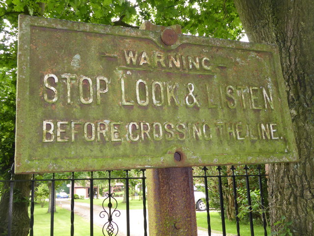
Image: © Marathon Taken: 9 Jun 2018
The Canterbury & Whitstable Railway is often said to have been the first passenger railway in the world. Construction of the 6 mile line took several years and work excavating the 828 yard Tyler Hill Tunnel proved difficult and lengthy. There were great celebrations for the opening on 3rd May 1830. In Canterbury, the cathedral bells were rung and guns were fired in salute. Sections of the line were so steeply graded that stationary engines were required to haul trains by cable up the steep ascents. After the First World War, bus competition began to cause problems and the line to Whitstable finally closed to passengers on 1st January 1931. Goods traffic continued for a number of years but final closure came on 1st December 1952 after which time the track was removed. A path now follows part of the old route and is known as the Crab & Winkle Way. Here though it a private driveway to a house known appropriately as 'The Halt'. The Halt is now a private residence converted from an engineer's cottage. This section of the old trackbed is particularly interesting as Blean & Tyler Hill Halt was located between here and Tyler Hill Road just behind where I am standing. It was opened in 1908 and closed a mere 22 years later with the last passenger train. See http://www.geograph.org.uk/photo/1832585 The other reminder that this was once a railway is this old sign - see http://www.geograph.org.uk/photo/5809261 for its location. See http://www.bbc.co.uk/kent/content/articles/2008/05/27/history_lost_railway_feature.shtml and https://en.wikipedia.org/wiki/Canterbury_and_Whitstable_Railway and http://crabandwinkle.org/?page_id=19
Images are licensed for reuse under creativecommons.org/licenses/by-sa/2.0
Image Location
Latitude
51.308894
Longitude
1.064006