Hatton war memorial
Introduction
The photograph on this page of Hatton war memorial by Bill Harrison as part of the Geograph project.
The Geograph project started in 2005 with the aim of publishing, organising and preserving representative images for every square kilometre of Great Britain, Ireland and the Isle of Man.

There are currently over 7.5m images from over 14,400 individuals and you can help contribute to the project by visiting https://www.geograph.org.uk
Hatton war memorial
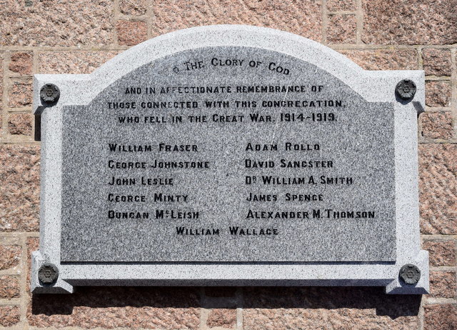
Image: © Bill Harrison Taken: 19 May 2018
Now attached to the community hall after the church was destroyed by fire in 2015 and was demolished as unsafe. Atypically, neither rank nor regiment of the fallen are specified.
Images are licensed for reuse under creativecommons.org/licenses/by-sa/2.0
Image Location
Latitude
57.424498
Longitude
-1.915231