Nether Edge as seen from Meersbrook Avenue
Introduction
The photograph on this page of Nether Edge as seen from Meersbrook Avenue by Richard Copley as part of the Geograph project.
The Geograph project started in 2005 with the aim of publishing, organising and preserving representative images for every square kilometre of Great Britain, Ireland and the Isle of Man.

There are currently over 7.5m images from over 14,400 individuals and you can help contribute to the project by visiting https://www.geograph.org.uk
Nether Edge as seen from Meersbrook Avenue
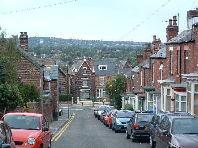
Image: © Richard Copley Taken: 26 Sep 2005
The image is taken from halfway up Meersbrook Avenue, looking North West across Chesterfield Road, towards Nether Edge. The hill on the horizon is the area around Fulwood and Broomhill. The large white tower block on the hill is the old Forte Posthouse Hotel in Fulwood.
Images are licensed for reuse under creativecommons.org/licenses/by-sa/2.0
Image Location


Leaflet Map data © OpenStreetMap
Latitude
53.357174
Longitude
-1.486115