Disused stables and house at Carlisle Racecourse (2013)
Introduction
The photograph on this page of Disused stables and house at Carlisle Racecourse (2013) by Rose and Trev Clough as part of the Geograph project.
The Geograph project started in 2005 with the aim of publishing, organising and preserving representative images for every square kilometre of Great Britain, Ireland and the Isle of Man.

There are currently over 7.5m images from over 14,400 individuals and you can help contribute to the project by visiting https://www.geograph.org.uk
Disused stables and house at Carlisle Racecourse (2013)
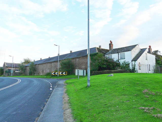
Image: © Rose and Trev Clough Taken: 9 Aug 2013
The building behind the chevrons is one side of a rectangular yard, originally part of Blackwell House Farm. The block was converted to stabling when Carlisle Racecourse relocated here from the Swifts in 1904. The white house (No.68 Durdar Road) had been boarded up for some years when this photo was taken. New stable facilities were opened at the southern end of the racecourse in 2006. These old buildings were redundant, and were demolished in autumn 2017 (see Image). The site will be redeveloped with housing.
Images are licensed for reuse under creativecommons.org/licenses/by-sa/2.0
Image Location
Latitude
54.867827
Longitude
-2.93282