Short curving wall
Introduction
The photograph on this page of Short curving wall by Lairich Rig as part of the Geograph project.
The Geograph project started in 2005 with the aim of publishing, organising and preserving representative images for every square kilometre of Great Britain, Ireland and the Isle of Man.

There are currently over 7.5m images from over 14,400 individuals and you can help contribute to the project by visiting https://www.geograph.org.uk
Short curving wall
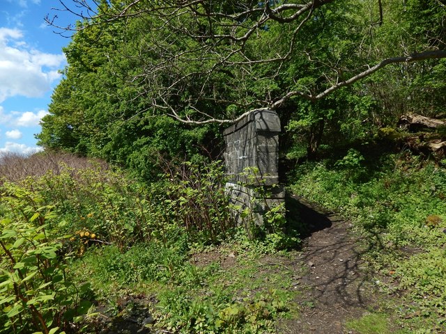
Image: © Lairich Rig Taken: 13 May 2018
The wall does not extend far beyond the point where it disappears under the vegetation. It has an opening on the left (the south, that is, the side facing the River Clyde), through which water is discharged: Image / Image The wall seems incongruous in its present setting alongside a path, but it serves as a reminder that the path follows the course of a dismantled railway line: Image
Images are licensed for reuse under creativecommons.org/licenses/by-sa/2.0
Image Location
Latitude
55.927669
Longitude
-4.475692