Building site, London Road
Introduction
The photograph on this page of Building site, London Road by John Baker as part of the Geograph project.
The Geograph project started in 2005 with the aim of publishing, organising and preserving representative images for every square kilometre of Great Britain, Ireland and the Isle of Man.

There are currently over 7.5m images from over 14,400 individuals and you can help contribute to the project by visiting https://www.geograph.org.uk
Building site, London Road
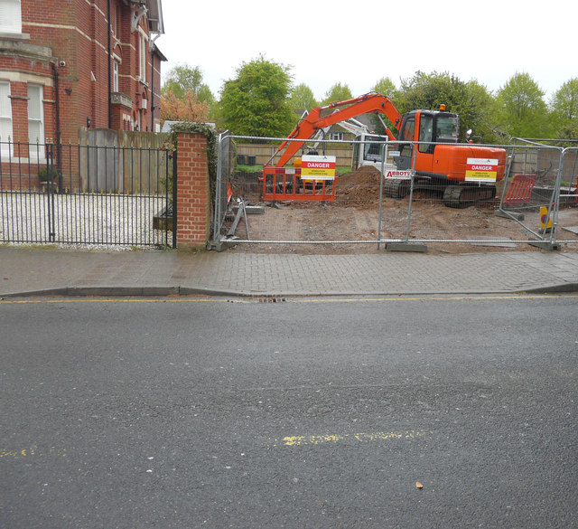
Image: © John Baker Taken: 29 Apr 2018
Planning permission has been granted by Canterbury City Council under application number CA//16/02886 for a “variation of condition 02 (approved drawings) of appeal reference APP/J2210/W/15/3140462, (planning application CA/15/01179/FUL) for demolition of house and construction of new building incorporating 10 flats, to allow amendments to internal layout, addition of dormer to front and roof-lights to side elevation”. This image shows the house numbered Image that stood on the site and before it was demolished. Image now stands here.
Images are licensed for reuse under creativecommons.org/licenses/by-sa/2.0
Image Location
Latitude
51.282058
Longitude
1.065231