John Brown shipyard
Introduction
The photograph on this page of John Brown shipyard by Ewan Carmichael Douglas as part of the Geograph project.
The Geograph project started in 2005 with the aim of publishing, organising and preserving representative images for every square kilometre of Great Britain, Ireland and the Isle of Man.

There are currently over 7.5m images from over 14,400 individuals and you can help contribute to the project by visiting https://www.geograph.org.uk
John Brown shipyard
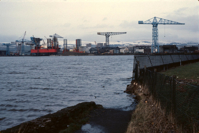
Image: © Ewan Carmichael Douglas Taken: Unknown
Taken from where the river Cart meets the Clyde, next to Renfrew golf course. The path by the rivers has since been repaired so you don't need to go over the fence. John Brown's built oil rigs at the time.
Images are licensed for reuse under creativecommons.org/licenses/by-sa/2.0
Image Location
Latitude
55.894906
Longitude
-4.400985