"Brocket" Boyn Hill Avenue
Introduction
The photograph on this page of "Brocket" Boyn Hill Avenue by Des Blenkinsopp as part of the Geograph project.
The Geograph project started in 2005 with the aim of publishing, organising and preserving representative images for every square kilometre of Great Britain, Ireland and the Isle of Man.

There are currently over 7.5m images from over 14,400 individuals and you can help contribute to the project by visiting https://www.geograph.org.uk
"Brocket" Boyn Hill Avenue
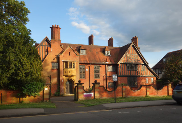
Image: © Des Blenkinsopp Taken: 10 May 2018
Seen here catching the last of the evening sunlight, Brocket is an Edwardian mansion built 1906-7 as a private residence, which it was until 1937. It is now owned by Maidenhead Council. Listing and history on https://www.britishlistedbuildings.co.uk/101392401-brocket-boyn-hill-ward#.WvWTVq2ZORs
Images are licensed for reuse under creativecommons.org/licenses/by-sa/2.0
Image Location
Latitude
51.52009
Longitude
-0.733647