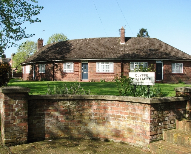
Crescent at Clyffe Cottages
Introduction
The photograph on this page of Crescent at Clyffe Cottages by Evelyn Simak as part of the Geograph project.
The Geograph project started in 2005 with the aim of publishing, organising and preserving representative images for every square kilometre of Great Britain, Ireland and the Isle of Man.
There are currently over 7.5m images from over 14,400 individuals and you can help contribute to the project by visiting https://www.geograph.org.uk

Image: © Evelyn Simak Taken: 4 May 2018
Originally, Clyffe Cottages, built in 1948 > http://www.geograph.org.uk/photo/5762878 was a residential scheme by the Colmans, which provided 16 flats for Colman pensioners, arranged in two crescents and a centrally-placed Warden’s House. The buildings are situated behind a grassed area set back from the street near the Bracondale/Corton Road junction and are currently owned by the Broadland Housing Association.

