Main Road, Wylam
Introduction
The photograph on this page of Main Road, Wylam by Andrew Curtis as part of the Geograph project.
The Geograph project started in 2005 with the aim of publishing, organising and preserving representative images for every square kilometre of Great Britain, Ireland and the Isle of Man.

There are currently over 7.5m images from over 14,400 individuals and you can help contribute to the project by visiting https://www.geograph.org.uk
Main Road, Wylam
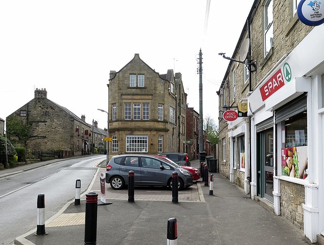
Image: © Andrew Curtis Taken: 1 May 2018
The building facing was at one time another of Wylam's several public houses, The Bird Inn. The property is joined to the Ship Inn which is still in business Image A building plan illustrates the propsed re-building of 'The Bird Inn' at Wylam for Newcastle Breweries Ltd in 1897 and was approved by Hexham Rural District Council on the 8th June 1897 https://communities.northumberland.gov.uk/008865.htm On the right is the Spar grocers, now including the post office business which was previously across the road Image
Images are licensed for reuse under creativecommons.org/licenses/by-sa/2.0
Image Location
Latitude
54.976153
Longitude
-1.82343