Former Canal restaurant
Introduction
The photograph on this page of Former Canal restaurant by Richard Sutcliffe as part of the Geograph project.
The Geograph project started in 2005 with the aim of publishing, organising and preserving representative images for every square kilometre of Great Britain, Ireland and the Isle of Man.

There are currently over 7.5m images from over 14,400 individuals and you can help contribute to the project by visiting https://www.geograph.org.uk
Former Canal restaurant
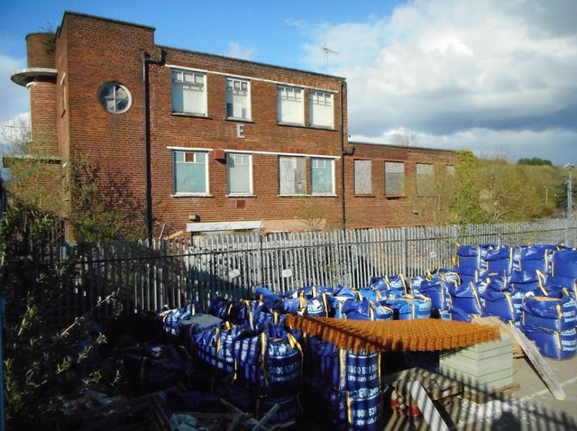
Image: © Richard Sutcliffe Taken: 27 Apr 2018
Originally built as offices for the Temple Saw Mills circa 1938, the building was converted into the Canal restaurant and microbrewery in 1998. By 2006 it was vacant and boarded up and has suffered from damage to windows and graffiti. It is Category C listed [http://portal.historicenvironment.scot/designation/LB32170] and is on the Buildings at Risk Register [https://www.buildingsatrisk.org.uk/search/keyword/anniesland/event_id/910674/building_name/canal-bar-restaurant-former-380-bearsden-road-anniesland]. The blue bags are in the yard of Jewsons next door.
Images are licensed for reuse under creativecommons.org/licenses/by-sa/2.0
Image Location
Latitude
55.89507
Longitude
-4.322139