Charlie's Corner, Wylam
Introduction
The photograph on this page of Charlie's Corner, Wylam by Andrew Curtis as part of the Geograph project.
The Geograph project started in 2005 with the aim of publishing, organising and preserving representative images for every square kilometre of Great Britain, Ireland and the Isle of Man.

There are currently over 7.5m images from over 14,400 individuals and you can help contribute to the project by visiting https://www.geograph.org.uk
Charlie's Corner, Wylam
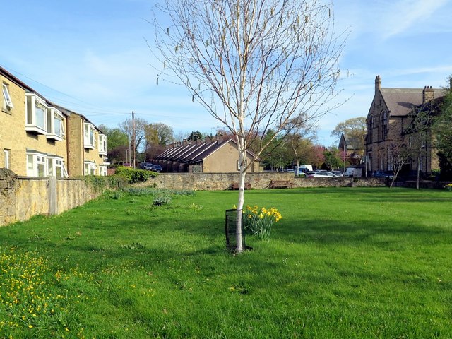
Image: © Andrew Curtis Taken: 27 Apr 2018
A small area of open space flanked by Ovingham Road and Church Road. The front of Wylam Institute can be seen on the right. A two-storey white-washed building on this plot formerly served partly as the Institute and part as a cottage. It was demolished sometime around 1920. Flats on the left are named Blackett Court. The cottages in the distance are Image Charlie's Corner was named for Mr Charles Atkinson of West House, round the corner on the Ovingham Road, who acquired and gave the land to the Parish Council around 1950. He was very prominent in village life and was a leading figure in the planning of the village war memorial, its construction and unveiling in 1923.
Images are licensed for reuse under creativecommons.org/licenses/by-sa/2.0
Image Location
Latitude
54.975975
Longitude
-1.824681