Common Moor
Introduction
The photograph on this page of Common Moor by Derek Harper as part of the Geograph project.
The Geograph project started in 2005 with the aim of publishing, organising and preserving representative images for every square kilometre of Great Britain, Ireland and the Isle of Man.

There are currently over 7.5m images from over 14,400 individuals and you can help contribute to the project by visiting https://www.geograph.org.uk
Common Moor
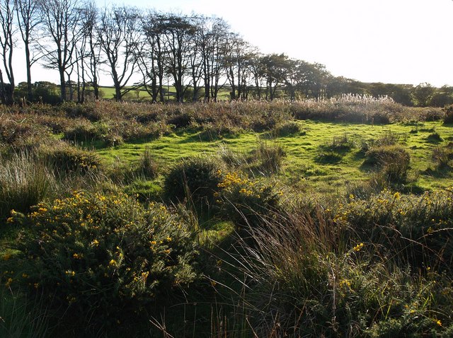
Image: © Derek Harper Taken: 4 Oct 2007
The eastern part of this stretch of access land (to which, incidentally, there is no practical access) consists of heath-like terrain dominated by gorse and rushes, with extremely marshy spots. The row of beech trees runs along the southern edge, following a parish boundary.
Images are licensed for reuse under creativecommons.org/licenses/by-sa/2.0
Image Location


Leaflet Map data © OpenStreetMap
Latitude
50.896534
Longitude
-4.19052