Along the Thames Path at Dukes Meadows
Introduction
The photograph on this page of Along the Thames Path at Dukes Meadows by Marathon as part of the Geograph project.
The Geograph project started in 2005 with the aim of publishing, organising and preserving representative images for every square kilometre of Great Britain, Ireland and the Isle of Man.

There are currently over 7.5m images from over 14,400 individuals and you can help contribute to the project by visiting https://www.geograph.org.uk
Along the Thames Path at Dukes Meadows
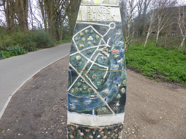
Image: © Marathon Taken: 4 Apr 2018
The Thames Path follows both sides of the River Thames here. This is on the north (Middlesex) side as the path leaves a built-up area and heads towards Barnes Railway Bridge. The sculpture has a map of this section of the Thames. Its setting can be seen at https://www.geograph.org.uk/photo/5749968
Images are licensed for reuse under creativecommons.org/licenses/by-sa/2.0
Image Location
Latitude
51.479096
Longitude
-0.251639