The Salvation Army Citadel, Edward Street, Portadown.
Introduction
The photograph on this page of The Salvation Army Citadel, Edward Street, Portadown. by P Flannagan as part of the Geograph project.
The Geograph project started in 2005 with the aim of publishing, organising and preserving representative images for every square kilometre of Great Britain, Ireland and the Isle of Man.

There are currently over 7.5m images from over 14,400 individuals and you can help contribute to the project by visiting https://www.geograph.org.uk
The Salvation Army Citadel, Edward Street, Portadown.
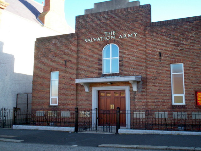
Image: © P Flannagan Taken: 4 Oct 2007
In 1881 The Portadown Corps commenced it's ministry to the people of the town. The local Salvation Army Hall located in Edward Street Portadown although burned down the foundation stones for the current hall were laid in November 1939 and it was rebuilt on the same site. The new halls opened on 4th May 1940.
Images are licensed for reuse under creativecommons.org/licenses/by-sa/2.0
Image Location


Leaflet Map data © OpenStreetMap
Latitude
54.421357
Longitude
-6.442009