Bunny, Notts.
Introduction
The photograph on this page of Bunny, Notts. by David Hallam-Jones as part of the Geograph project.
The Geograph project started in 2005 with the aim of publishing, organising and preserving representative images for every square kilometre of Great Britain, Ireland and the Isle of Man.

There are currently over 7.5m images from over 14,400 individuals and you can help contribute to the project by visiting https://www.geograph.org.uk
Bunny, Notts.
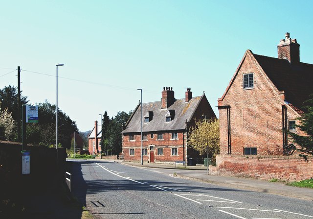
Image: © David Hallam-Jones Taken: 20 Apr 2018
The A60 (the Nottingham-Loughborough Road). This is the view that motorists see as they approach the village, i.e. Nottingham is 15 or so miles behind the photographer and Rempstone and Loughborough lie ahead. The central building forms the former village school and almshouses that were designed and built for Sir Thomas Parkyn in 1700, for the people of the combined parish of Bunny and Bradmore. Bunny (originally known as Bune - and relating to reed beds - and Bradmore (originally Broad Meare, i.e. where reeds were once grown) seem always to have been linked.
Images are licensed for reuse under creativecommons.org/licenses/by-sa/2.0
Image Location
Latitude
52.861182
Longitude
-1.134626