Cabman's Shelter in Warwick Avenue
Introduction
The photograph on this page of Cabman's Shelter in Warwick Avenue by Oxyman as part of the Geograph project.
The Geograph project started in 2005 with the aim of publishing, organising and preserving representative images for every square kilometre of Great Britain, Ireland and the Isle of Man.

There are currently over 7.5m images from over 14,400 individuals and you can help contribute to the project by visiting https://www.geograph.org.uk
Cabman's Shelter in Warwick Avenue
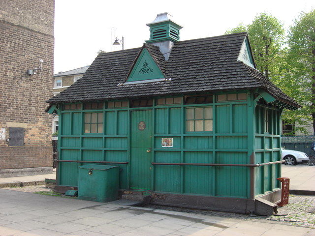
Image: © Oxyman Taken: 27 Apr 2007
The Cabmen's Shelter Fund was established in London in 1875 to run shelters for the drivers of hansom cabs and later hackney carriages. By law, cab drivers could not leave the cab stand while their cab was parked there. This made it very difficult for them to obtain hot meals and could be unpleasant in bad weather. If they drove to a pub to buy food then they would have to pay somebody to look after their cab while they were inside, otherwise it was likely to be stolen. The Earl of Shaftesbury and other worthies therefore took it upon themselves to set up a charity to construct and run shelters at major cab stands. These shelters were small green huts, which were not allowed to be larger than a horse and cart, as they stood on the public highway. Between 1875 and 1914, 61 of these buildings were built around London. Most were staffed by an attendant who sold food and (non-alcoholic) drink to the cabbies and were provided with a kitchen in which the attendant could cook this food and also food provided by the cabbies themselves. The attendant was not generally paid, but was expected to make an income from these sales. The shelters were also provided with seats and tables and books and newspapers, most of them donated by the publishers or other benefactors. Most could accommodate ten to thirteen men. Gambling, drinking and swearing were strictly forbidden. Thirteen of the shelters still exist and are still run by the Cabmen's Shelter Fund. All are now Grade II listed buildings. This one, in Warwick Avenue W9 is in the centre of the road, by Warwick Avenue tube station.
Images are licensed for reuse under creativecommons.org/licenses/by-sa/2.0
Image Location
Latitude
51.52338
Longitude
-0.183346