High Street
Introduction
The photograph on this page of High Street by Ian Capper as part of the Geograph project.
The Geograph project started in 2005 with the aim of publishing, organising and preserving representative images for every square kilometre of Great Britain, Ireland and the Isle of Man.

There are currently over 7.5m images from over 14,400 individuals and you can help contribute to the project by visiting https://www.geograph.org.uk
High Street
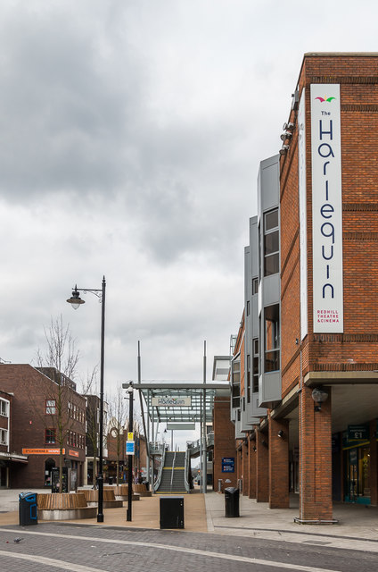
Image: © Ian Capper Taken: 1 Apr 2018
Looking along High Street from its junction with Station Road, with part of the 1982 Warwick Quadrant on the right, this corner previously being the site of the Market Hall, dating from 1859 onwards. Compare Image - the original canopy, added in 1986, was replaced in 2016 as part of the Warwick Quadrant redevelopment.
Images are licensed for reuse under creativecommons.org/licenses/by-sa/2.0
Image Location
Latitude
51.240854
Longitude
-0.168052