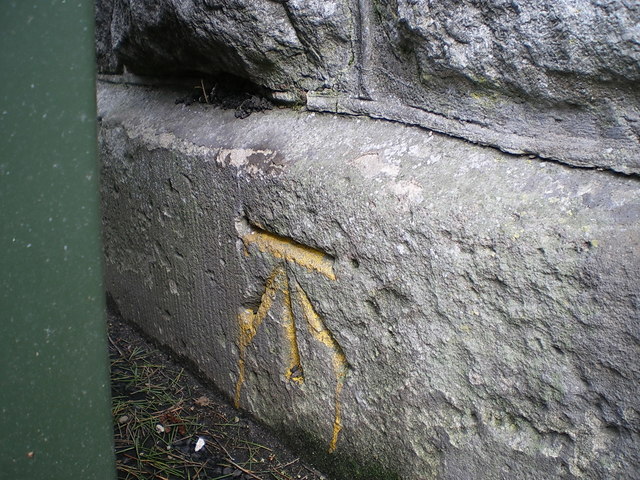
OS benchmark - Much Wenlock, wall at the end of Station Road
Introduction
The photograph on this page of OS benchmark - Much Wenlock, wall at the end of Station Road by Richard Law as part of the Geograph project.
The Geograph project started in 2005 with the aim of publishing, organising and preserving representative images for every square kilometre of Great Britain, Ireland and the Isle of Man.
There are currently over 7.5m images from over 14,400 individuals and you can help contribute to the project by visiting https://www.geograph.org.uk

Image: © Richard Law Taken: 8 Apr 2018
An OS cutmark at the corner of Station Road where it joins Sheinton Street; it lies on the stonework associated with the former overbridge of the railway line (just offshot to the left of the litter bin seen in Image), and was most recently levelled in 1966 at 153.930m above Ordnance Datum Newlyn. It appears on the 1901 map at 505ft 6in, so was presumably originally part of the 1st Geodetic Levelling survey, and relates in that case to Liverpool Datum.

