Kingston by Sea, St. Julian's
Introduction
The photograph on this page of Kingston by Sea, St. Julian's by Mike Faherty as part of the Geograph project.
The Geograph project started in 2005 with the aim of publishing, organising and preserving representative images for every square kilometre of Great Britain, Ireland and the Isle of Man.

There are currently over 7.5m images from over 14,400 individuals and you can help contribute to the project by visiting https://www.geograph.org.uk
Kingston by Sea, St. Julian's
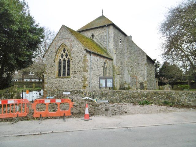
Image: © Mike Faherty Taken: 7 Apr 2018
Parish church on St. Julian's Lane; dating from C12, with vernacular flint walls. http://www.pastscape.org.uk/hob.aspx?hob_id=398768&sort=2&rational=m&recordsperpage=10&maplat=50.83301932&maplong=-0.24533237&mapisa=1000&mapist=os&mapilo=-0.2453&mapila=50.8330&mapiloe=w&mapilan=n&mapios=TQ235052&mapigrn=105250&mapigre=523550&mapipc=#aRt Footpaths to the church are currently being renovated.
Images are licensed for reuse under creativecommons.org/licenses/by-sa/2.0
Image Location
Latitude
50.833332
Longitude
-0.246625