Cwm & Llantwit Welfare Hall, Tynant
Introduction
The photograph on this page of Cwm & Llantwit Welfare Hall, Tynant by Jaggery as part of the Geograph project.
The Geograph project started in 2005 with the aim of publishing, organising and preserving representative images for every square kilometre of Great Britain, Ireland and the Isle of Man.

There are currently over 7.5m images from over 14,400 individuals and you can help contribute to the project by visiting https://www.geograph.org.uk
Cwm & Llantwit Welfare Hall, Tynant
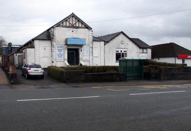
Image: © Jaggery Taken: 7 Apr 2018
Viewed across the B4595. The Coflein website records that Cwm & Llantwit Welfare Hall was officially opened on October 21st 1933. The building contained a public hall (capacity 450), billiards hall, reading room and library. A smaller hall was unveiled in 1949. Extensions to the main hall in 1956 raised its capacity to 516. Difficulties in maintaining the hall as a going concern were ended with the arrival of a cinema - the Welfare Hall was renamed the Gaiety Cinema. The cinema closed in June 1964 at which time the former name was revived. Other activities hosted were boxing matches and dancing sessions. The hall remains in use as a social club.
Images are licensed for reuse under creativecommons.org/licenses/by-sa/2.0
Image Location
Latitude
51.55669
Longitude
-3.354111