OS benchmark - Isombridge Farm
Introduction
The photograph on this page of OS benchmark - Isombridge Farm by Richard Law as part of the Geograph project.
The Geograph project started in 2005 with the aim of publishing, organising and preserving representative images for every square kilometre of Great Britain, Ireland and the Isle of Man.

There are currently over 7.5m images from over 14,400 individuals and you can help contribute to the project by visiting https://www.geograph.org.uk
OS benchmark - Isombridge Farm
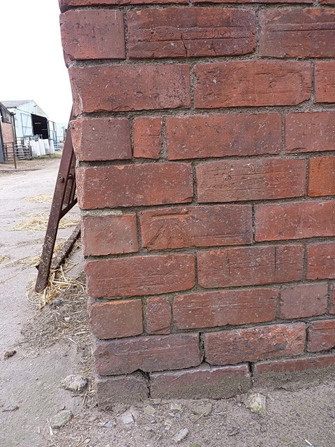
Image: © Richard Law Taken: 23 Mar 2018
An OS cutmark on the wall of one of the barns at Isombridge Farm. It was last levelled in 1966 at 50.774m above Ordnance Datum Newlyn, and appears to replace an older mark (shown on maps around the turn of the 19th century) located on the farm wall more or less in front of Image
Images are licensed for reuse under creativecommons.org/licenses/by-sa/2.0
Image Location


Leaflet Map data © OpenStreetMap
Latitude
52.720155
Longitude
-2.577452