Demolition of Harvest House
Introduction
The photograph on this page of Demolition of Harvest House by Ian Capper as part of the Geograph project.
The Geograph project started in 2005 with the aim of publishing, organising and preserving representative images for every square kilometre of Great Britain, Ireland and the Isle of Man.

There are currently over 7.5m images from over 14,400 individuals and you can help contribute to the project by visiting https://www.geograph.org.uk
Demolition of Harvest House
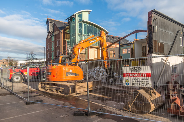
Image: © Ian Capper Taken: 1 Dec 2017
Former office building in Portcullis Lane, seen here being demolished with a view to replacement with an 11 unit residential block, as an extension to the existing Marstons Mill building (in the background), now Ludlow Foyer, a housing project for young people aged 16-25. Part of the original building can be seen on the right of Image
Images are licensed for reuse under creativecommons.org/licenses/by-sa/2.0
Image Location
Latitude
52.370426
Longitude
-2.717158