Currock Street, Carlisle - March 2018
Introduction
The photograph on this page of Currock Street, Carlisle - March 2018 by The Carlisle Kid as part of the Geograph project.
The Geograph project started in 2005 with the aim of publishing, organising and preserving representative images for every square kilometre of Great Britain, Ireland and the Isle of Man.

There are currently over 7.5m images from over 14,400 individuals and you can help contribute to the project by visiting https://www.geograph.org.uk
Currock Street, Carlisle - March 2018
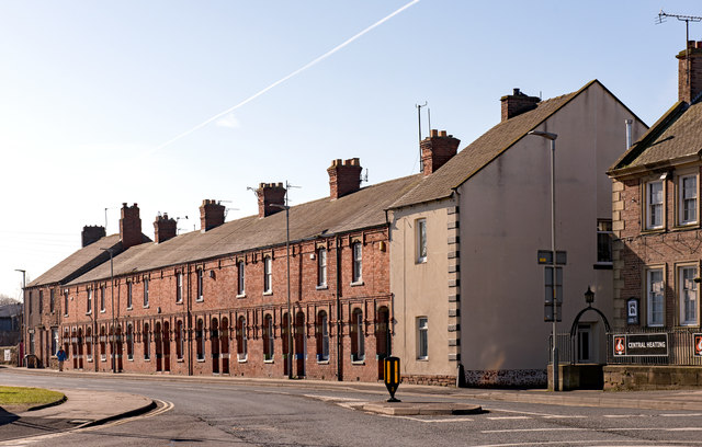
Image: © The Carlisle Kid Taken: 26 Mar 2018
Only the south side survives of Victorian Currock Street - but it gives some indication of the density of pubs in Carlisle in 1916. To the right can be seen the former "Cumberland Wrestlers" (see: Image] ) while at far left is the long closed "Moulders Arms" (see: Image] ). Behind me would have been the "Oddfellows Inn" (see: Image] ) while a few minutes walk north from the "Moulders Arms" was the "Goliah/Goliath Inn" (see: Image] ).
Images are licensed for reuse under creativecommons.org/licenses/by-sa/2.0
Image Location
Latitude
54.887861
Longitude
-2.933595