Spoil heap from Rotherhope Fell Mine
Introduction
The photograph on this page of Spoil heap from Rotherhope Fell Mine by Trevor Littlewood as part of the Geograph project.
The Geograph project started in 2005 with the aim of publishing, organising and preserving representative images for every square kilometre of Great Britain, Ireland and the Isle of Man.

There are currently over 7.5m images from over 14,400 individuals and you can help contribute to the project by visiting https://www.geograph.org.uk
Spoil heap from Rotherhope Fell Mine
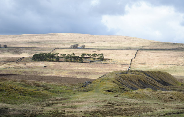
Image: © Trevor Littlewood Taken: 25 Mar 2018
The spoil heap here is from the Middle Level entrance. The mine's main entrance was the Blackburn Level which is in the valley of the Black Burn, in the dip between the shadowed foreground and the sunlit hill beyond.
Images are licensed for reuse under creativecommons.org/licenses/by-sa/2.0
Image Location
Latitude
54.774062
Longitude
-2.473315