Kimberley Church
Introduction
The photograph on this page of Kimberley Church by Stephen McKay as part of the Geograph project.
The Geograph project started in 2005 with the aim of publishing, organising and preserving representative images for every square kilometre of Great Britain, Ireland and the Isle of Man.

There are currently over 7.5m images from over 14,400 individuals and you can help contribute to the project by visiting https://www.geograph.org.uk
Kimberley Church
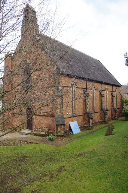
Image: © Stephen McKay Taken: 11 Mar 2018
Holy Trinity Church on Church Hill was consecrated in 1847 at a time when the population of the area was rapidly expanding. Kimberley, although an ancient settlement mentioned in the Domesday Book (as Chinemarelie), was a part of the parish of Greasley and the original intention was that the new building should act as a chapel of ease to Greasley Church. Kimberley became a parish in 1851, albeit with a curate in charge and an arrangement under which ecclesiastical fees were retained by the vicar of Greasley until the end of his incumbency, which occurred in 1866. More recently, the church underwent a major restoration in 1937.
Images are licensed for reuse under creativecommons.org/licenses/by-sa/2.0
Image Location
Latitude
52.998228
Longitude
-1.261371