Melin Llandegfan
Introduction
The photograph on this page of Melin Llandegfan by Chris Andrews as part of the Geograph project.
The Geograph project started in 2005 with the aim of publishing, organising and preserving representative images for every square kilometre of Great Britain, Ireland and the Isle of Man.

There are currently over 7.5m images from over 14,400 individuals and you can help contribute to the project by visiting https://www.geograph.org.uk
Melin Llandegfan
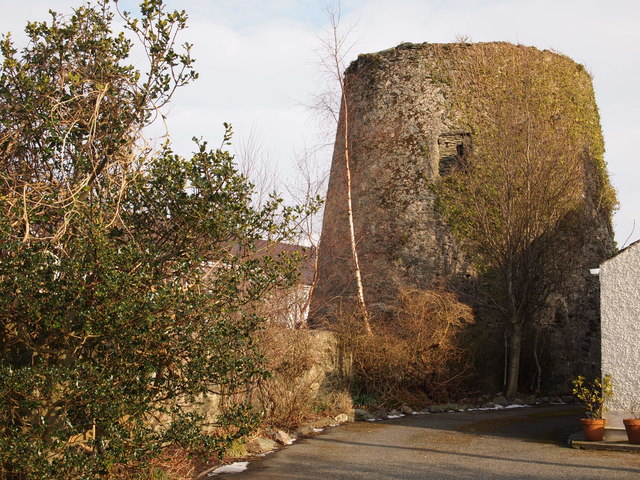
Image: © Chris Andrews Taken: 3 Mar 2018
Thought to have been built in the 1820's and fallen into disuse before the first world war. Remains of the cap and sails were reported as still in place in 1929, but had disappeared by the late nineteen thirties. The upper courses were removed at some time later. The windmill was then used as a water tower for the village, a storage tank being fitted and water abstracted from the Afon Cadnant. However this was replaced by a water main and the redundant tnk was finally removed in 1989.
Images are licensed for reuse under creativecommons.org/licenses/by-sa/2.0
Image Location
Latitude
53.243686
Longitude
-4.150435