
Course of old Portsmouth and Arundel Canal at Ford
Introduction
The photograph on this page of Course of old Portsmouth and Arundel Canal at Ford by Robin Webster as part of the Geograph project.
The Geograph project started in 2005 with the aim of publishing, organising and preserving representative images for every square kilometre of Great Britain, Ireland and the Isle of Man.

There are currently over 7.5m images from over 14,400 individuals and you can help contribute to the project by visiting https://www.geograph.org.uk
Course of old Portsmouth and Arundel Canal at Ford
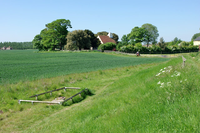
Image: © Robin Webster Taken: 24 May 2010
In the enclosure below the present day river wall are the only visible remains of the first lock out of the River Arun. The position and form of the remains indicate that it was where the southern upper gate was. The next lock was close by the building just showing on the right. The two locks raised the canal 12 ft above the level of high water spring tides in the Arun, in steps of 5 ft and 7 ft. So this first lock, more often than not, had a bigger rise. The canal had a navigable depth near 5 ft, so the remains, which are at the bottom of the upper gate, were a little below the level of high water spring tides. The canal would have been on or in an embankment about 6 ft above high water springs, this has been removed or buried under the modern river wall.
Images are licensed for reuse under creativecommons.org/licenses/by-sa/2.0
Image Location

Latitude
50.825145
Longitude
-0.576764