Coventry 2 Tone Trail Plaque - 16 Lower Holyhead road
Introduction
The photograph on this page of Coventry 2 Tone Trail Plaque - 16 Lower Holyhead road by 360Libre as part of the Geograph project.
The Geograph project started in 2005 with the aim of publishing, organising and preserving representative images for every square kilometre of Great Britain, Ireland and the Isle of Man.

There are currently over 7.5m images from over 14,400 individuals and you can help contribute to the project by visiting https://www.geograph.org.uk
Coventry 2 Tone Trail Plaque - 16 Lower Holyhead road
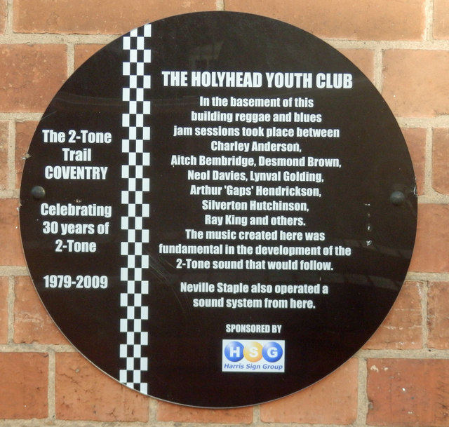
Image: © 360Libre Taken: 30 Jan 2018
Number 7 of the 11 plaques on the "2 Tone" trail celebrating the start of this 1980s genre of ska based music.
Images are licensed for reuse under creativecommons.org/licenses/by-sa/2.0
Image Location
Latitude
52.409189
Longitude
-1.517484