Corn Mill, Malin Bridge, Sheffield
Introduction
The photograph on this page of Corn Mill, Malin Bridge, Sheffield by David Hallam-Jones as part of the Geograph project.
The Geograph project started in 2005 with the aim of publishing, organising and preserving representative images for every square kilometre of Great Britain, Ireland and the Isle of Man.

There are currently over 7.5m images from over 14,400 individuals and you can help contribute to the project by visiting https://www.geograph.org.uk
Corn Mill, Malin Bridge, Sheffield
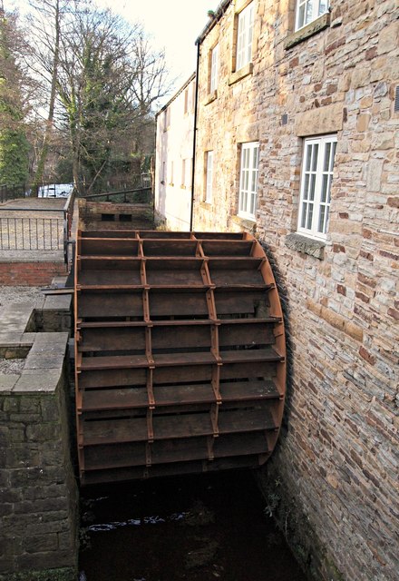
Image: © David Hallam-Jones Taken: 18 Feb 2018
This Grade II-listed mill is situated on the south side of the B6076, at the busy Stannington Road & Holme Lane junction. It seems that there has been a mill on this site since 1739, the original one being used for knife-grinding. In 1864 the mill was destroyed in a devastating flood after which a replacement was built by the Wilson family. Around 1915 it was converted to a corn mill - by the Marsden family - and functioned as such until 1956. It hosted various business enterprises since the mid-1950s before becoming disused. In 2006 Sheffield City Council sanctioned the construction of 23 new apartments to be built on the site under strict preservation conditions and the apartments and restoration work were completed during the second half of 2008. This is one of the few remaining examples of an undershot water wheel in the country, its potential power source being the River Loxley, as seen in the photo.
Images are licensed for reuse under creativecommons.org/licenses/by-sa/2.0
Image Location
Latitude
53.399979
Longitude
-1.51207