View from footbridge
Introduction
The photograph on this page of View from footbridge by Duncan Graham as part of the Geograph project.
The Geograph project started in 2005 with the aim of publishing, organising and preserving representative images for every square kilometre of Great Britain, Ireland and the Isle of Man.

There are currently over 7.5m images from over 14,400 individuals and you can help contribute to the project by visiting https://www.geograph.org.uk
View from footbridge
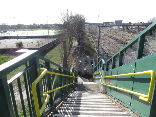
Image: © Duncan Graham Taken: 16 Feb 2018
Taken from the footbridge which crosses the railway line north-east of Clacton Railway Station, connecting Oxford Road with Clacton Leisure Centre and the recreation ground. To the right of picture is the railway line, with buildings on the industrial estate on Oxford Road visible. To the left are tennis courts forming part of the grounds of the leisure centre, with a children's play area beyond. Housing can be seen near the horizon. The footbridge is marked "FB" on Ordnance Survey maps. See Image and Image
Images are licensed for reuse under creativecommons.org/licenses/by-sa/2.0
Image Location
Latitude
51.79803
Longitude
1.158145