Skegby Trail
Introduction
The photograph on this page of Skegby Trail by Alan Walker as part of the Geograph project.
The Geograph project started in 2005 with the aim of publishing, organising and preserving representative images for every square kilometre of Great Britain, Ireland and the Isle of Man.

There are currently over 7.5m images from over 14,400 individuals and you can help contribute to the project by visiting https://www.geograph.org.uk
Skegby Trail
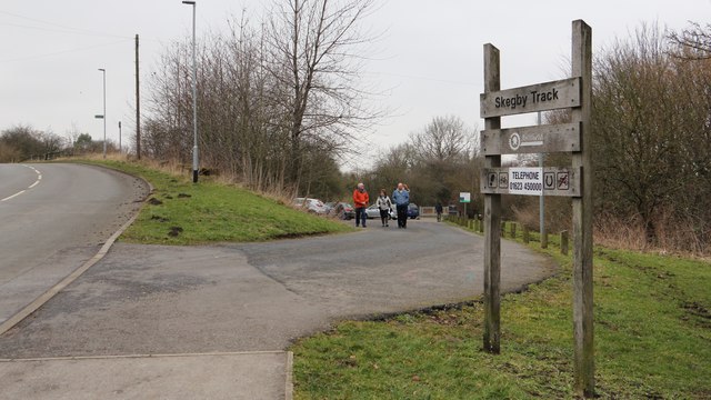
Image: © Alan Walker Taken: 18 Feb 2018
The photograph shows the entrance off Buttery Lane, Skegby into a car park for the Skegby Trail. When this trail was created it was called the 'Skegby Track' rather than the 'Skegby Trail' which, presumably, was a reference to these routes originally being railway tracks. Similar signage can be seen in this photograph at Image and in this photograph by Alan Murray-Rust of the Image The change from 'track' to 'trail' appears to have been made before Image was constructed. Originally there was another board above 'Skegby Track' where the wording 'Teversal Trails' was included. This was a collective reference to the group of three trails, namely the Skegby Trail, the Link Trail and the Teversal Trail. These trails are included in the Ashfield Trails Network http://www.nottinghamshire.gov.uk/planning-and-environment/countryside-and-green-spaces/green-spaces/teversal-trails and the Phoenix Greenways network https://derbyshire.gov.uk/images/Phoenix%20Greenways%202015%20web_tcm44-159660.pdf .' For a photograph of the Skegby Trail taken some 350m ahead, click here:- Image Behind the viewpoint there is Image
Images are licensed for reuse under creativecommons.org/licenses/by-sa/2.0
Image Location
Latitude
53.144843
Longitude
-1.261251