Bridgeway Centre, The Meadows
Introduction
The photograph on this page of Bridgeway Centre, The Meadows by Stephen McKay as part of the Geograph project.
The Geograph project started in 2005 with the aim of publishing, organising and preserving representative images for every square kilometre of Great Britain, Ireland and the Isle of Man.

There are currently over 7.5m images from over 14,400 individuals and you can help contribute to the project by visiting https://www.geograph.org.uk
Bridgeway Centre, The Meadows
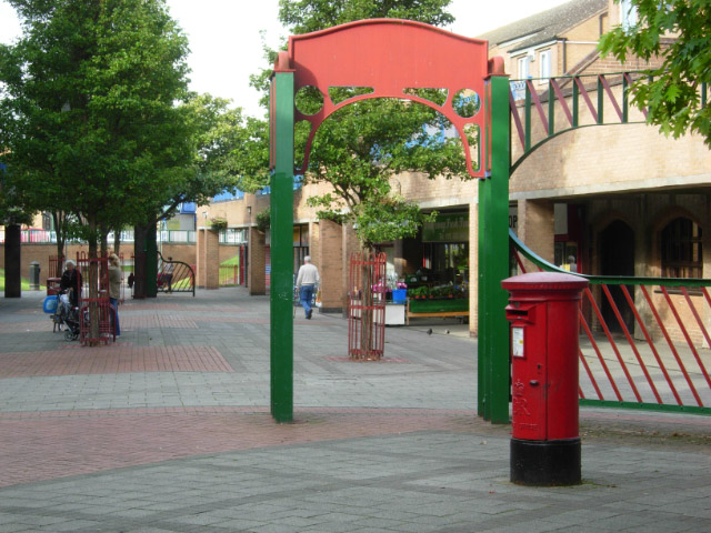
Image: © Stephen McKay Taken: 25 Sep 2007
The Meadows was an area of cheaply-built Victorian terraced housing situated on Nottingham's floodplain between the River Trent and the city centre. The area flooded seriously in 1947, although flood defences built in the 1950s have prevented a repeat. The area was comprehensively redeveloped in the 1970s, destroying the original street plan and the main thoroughfare - Arkwright Street. As so often with such comprehensive schemes, many people would say that the sense of community was swept away with the old houses. In the new scheme this shopping centre forms the centrepiece, and while it may not be very attractive visually, there is a range of independent shops that would do many more affluent suburbs proud.
Images are licensed for reuse under creativecommons.org/licenses/by-sa/2.0
Image Location
Latitude
52.943701
Longitude
-1.146225