Clochkeil stone row
Introduction
The photograph on this page of Clochkeil stone row by Sandy Gerrard as part of the Geograph project.
The Geograph project started in 2005 with the aim of publishing, organising and preserving representative images for every square kilometre of Great Britain, Ireland and the Isle of Man.

There are currently over 7.5m images from over 14,400 individuals and you can help contribute to the project by visiting https://www.geograph.org.uk
Clochkeil stone row
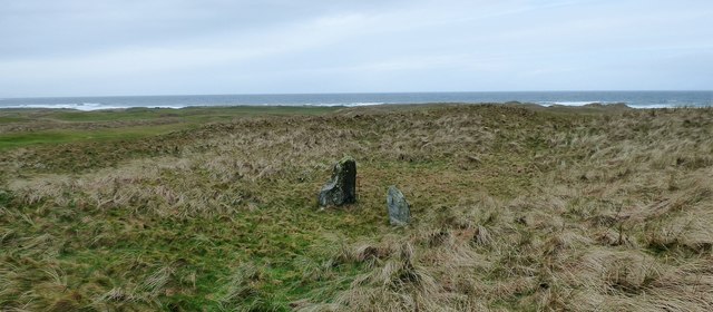
Image: © Sandy Gerrard Taken: 16 Mar 2017
Originally there were at least three stones here. Now only two stones remain (Scale 1m). https://stonerows.wordpress.com/gazetteer/region/argyll-and-isles/clochkeil/
Images are licensed for reuse under creativecommons.org/licenses/by-sa/2.0
Image Location
Latitude
55.457675
Longitude
-5.70629