38, Whitstable Road
Introduction
The photograph on this page of 38, Whitstable Road by John Baker as part of the Geograph project.
The Geograph project started in 2005 with the aim of publishing, organising and preserving representative images for every square kilometre of Great Britain, Ireland and the Isle of Man.

There are currently over 7.5m images from over 14,400 individuals and you can help contribute to the project by visiting https://www.geograph.org.uk
38, Whitstable Road
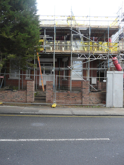
Image: © John Baker Taken: 4 Feb 2018
Planning permission has been granted by Canterbury City Council under application number CA//14/02295 for the “extension of existing dwelling and erection of four-unit apartment block”. This image shows Image before any work started. It is referred to as the ‘existing dwelling’ in the planning application.
Images are licensed for reuse under creativecommons.org/licenses/by-sa/2.0
Image Location
Latitude
51.285193
Longitude
1.069169