The Five Pits Trail Williamthorpe loop
Introduction
The photograph on this page of The Five Pits Trail Williamthorpe loop by Alan Walker as part of the Geograph project.
The Geograph project started in 2005 with the aim of publishing, organising and preserving representative images for every square kilometre of Great Britain, Ireland and the Isle of Man.

There are currently over 7.5m images from over 14,400 individuals and you can help contribute to the project by visiting https://www.geograph.org.uk
The Five Pits Trail Williamthorpe loop
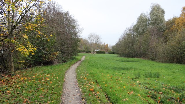
Image: © Alan Walker Taken: 31 Oct 2017
Walking the Five Pits Trail loop around Holmewood and Williamthorpe Image : Previous – (3 of 21) - Next : Image The photograph shows the Five Pits Trail as it approaches, from the south-west, Heath Road in Holmewood. Ahead the trail continues on, through the site of the Great Central Railway's Heath Station, toward the ponds and nature reserve at Williamthorpe before joining the main route of the trail at Wolfie Pond. The Holmewood Industrial Estate, which is built on the site of Hardwick Colliery and its railway sidings, is just to the right of the viewpoint. - - - An OS map surveyed in 1914 and published in 1921 shows that Hardwick Colliery was serviced by two railway companies, the Midland Railway and the Great Central Railway. The Great Central Railway's access was a route from the south, via Tibshelf that continued on northward toward Staveley with a branch via Chesterfield. The Midland Railway's Pilsley Extension line passed close to the west and the company built its Hardwick Colliery Branch to the colliery from that line.
Images are licensed for reuse under creativecommons.org/licenses/by-sa/2.0
Image Location
Latitude
53.188873
Longitude
-1.35119