Platt Chapel
Introduction
The photograph on this page of Platt Chapel by Gerald England as part of the Geograph project.
The Geograph project started in 2005 with the aim of publishing, organising and preserving representative images for every square kilometre of Great Britain, Ireland and the Isle of Man.

There are currently over 7.5m images from over 14,400 individuals and you can help contribute to the project by visiting https://www.geograph.org.uk
Platt Chapel
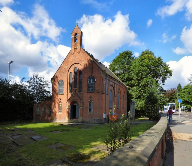
Image: © Gerald England Taken: 15 Sep 2017
The grade II listed https://historicengland.org.uk/listing/the-list/list-entry/1270509 Unitarian Chapel on Wilmslow Road opened in 1700 for the use of the Nonconformists. The local landed gentry, the Worsleys of Platt Hall, (donors of the site), the Edges and the Siddalls being the principal members of the congregation. The Chapel continued in use until 1970, the teaching becoming Unitarian in the course of the 18th century. During the middle of the 19th century there were alterations to the Chapel and in 1909 Wilmslow Road was widened, thus reducing the size of the surrounding graveyard. http://rusholmearchive.org/platt-chapel (Rusholme Archives). In recent times it has been the home of the Manchester Amateur Photographic Society (pre 2008), used as a live comedy venue (2012), a vintage clothing emporium (2015) and currently is the offices of Astute Estates property management services. There have been past plans to convert it into a community centre and to convert it into a 9-bedroom luxury home but neither have come to pass.
Images are licensed for reuse under creativecommons.org/licenses/by-sa/2.0
Image Location


Leaflet Map data © OpenStreetMap
Latitude
53.446705
Longitude
-2.218729