Horning Ferry Drainage Mill
Introduction
The photograph on this page of Horning Ferry Drainage Mill by Ian Capper as part of the Geograph project.
The Geograph project started in 2005 with the aim of publishing, organising and preserving representative images for every square kilometre of Great Britain, Ireland and the Isle of Man.

There are currently over 7.5m images from over 14,400 individuals and you can help contribute to the project by visiting https://www.geograph.org.uk
Horning Ferry Drainage Mill
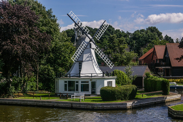
Image: © Ian Capper Taken: 9 Aug 2008
Former drainage mill dating from the mid 19th Century, converted into a holiday home in the 1930s. Grade II listed - see www.historicengland.org.uk/listing/the-list/list-entry/1171713
Images are licensed for reuse under creativecommons.org/licenses/by-sa/2.0
Image Location
Latitude
52.697051
Longitude
1.469026