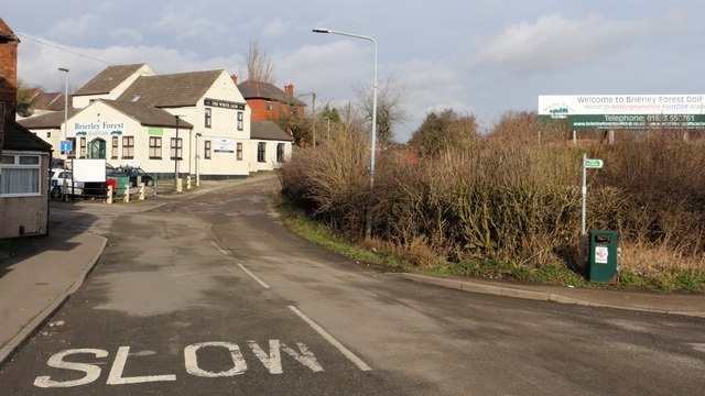
The junction of Main Street and Barker Street
Introduction
The photograph on this page of The junction of Main Street and Barker Street by Alan Walker as part of the Geograph project.
The Geograph project started in 2005 with the aim of publishing, organising and preserving representative images for every square kilometre of Great Britain, Ireland and the Isle of Man.
There are currently over 7.5m images from over 14,400 individuals and you can help contribute to the project by visiting https://www.geograph.org.uk

Image: © Alan Walker Taken: 30 Jan 2018
The viewpoint of this photograph is at the northern of Main Street in Huthwaite. Ahead and to the left is the junction with Image, a cul-de-sac. To the right is a Image that leads to an Image at the northern end of Newcastle Street. Straight ahead a public right of way follows the track passed Brierley Forest Golf Club buildings and then onto a public footpaths which loop round into Barker Street, lead on into Brierley Forest Park visitor centre or link with the Brierley Branch Line. The Brierley Branch Line ( https://www.derbyshire.gov.uk/images/Phoenix%20Greenways%202015%20web_tcm44-159660.pdf ) follows the old trackbed of the Midland Railway's Skegby branch line.

