Rooftops, Clacton town centre, looking south-west from Carnarvon Road
Introduction
The photograph on this page of Rooftops, Clacton town centre, looking south-west from Carnarvon Road by Duncan Graham as part of the Geograph project.
The Geograph project started in 2005 with the aim of publishing, organising and preserving representative images for every square kilometre of Great Britain, Ireland and the Isle of Man.

There are currently over 7.5m images from over 14,400 individuals and you can help contribute to the project by visiting https://www.geograph.org.uk
Rooftops, Clacton town centre, looking south-west from Carnarvon Road
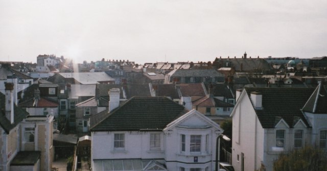
Image: © Duncan Graham Taken: 11 Apr 2004
Taken from the fourth floor of a block of flats on Carnarvon Road (the A133). The view has little changed in 2018. The green dome visible on the right of the picture is at the corner of the High Street and Station Road; it was once (early 1950s) part of Barclays Bank and is now a Sense charity shop. The black plate-glass building (Magnet House) at the extreme right on the horizon is on the corner of Jackson Road and Rosemary Road West; it houses Clacton social services.
Images are licensed for reuse under creativecommons.org/licenses/by-sa/2.0
Image Location
Latitude
51.788615
Longitude
1.153716