Tanfield Road, Croydon, Surrey - South side
Introduction
The photograph on this page of Tanfield Road, Croydon, Surrey - South side by Dr Neil Clifton as part of the Geograph project.
The Geograph project started in 2005 with the aim of publishing, organising and preserving representative images for every square kilometre of Great Britain, Ireland and the Isle of Man.

There are currently over 7.5m images from over 14,400 individuals and you can help contribute to the project by visiting https://www.geograph.org.uk
Tanfield Road, Croydon, Surrey - South side
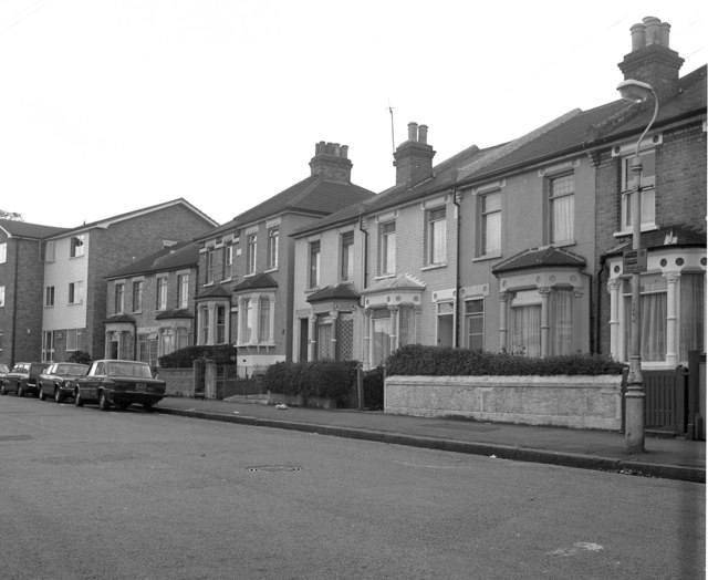
Image: © Dr Neil Clifton Taken: 14 Oct 1979
The south side of Tanfield Road shows a mixture of housing types: probably Edwardian period terrace houses and semis - clearly built before the motor car had become popular - and at the far end, a block infilled with what are obviously post-WW2 apartments.
Images are licensed for reuse under creativecommons.org/licenses/by-sa/2.0
Image Location
Latitude
51.366908
Longitude
-0.10378