Grey House farmhouse
Introduction
The photograph on this page of Grey House farmhouse by Richard Law as part of the Geograph project.
The Geograph project started in 2005 with the aim of publishing, organising and preserving representative images for every square kilometre of Great Britain, Ireland and the Isle of Man.

There are currently over 7.5m images from over 14,400 individuals and you can help contribute to the project by visiting https://www.geograph.org.uk
Grey House farmhouse
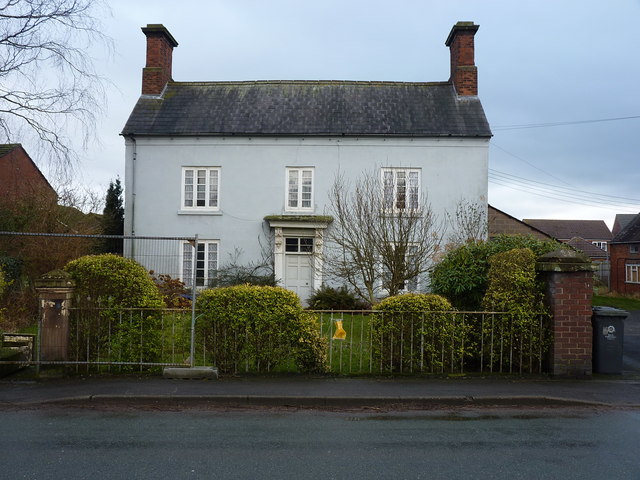
Image: © Richard Law Taken: 23 Jan 2018
An early 19th century farmhouse, which was Grade II listed https://www.britishlistedbuildings.co.uk/101039285-grey-house-farmhouse-and-garden-railings-and-gateway-lapley-stretton-and-wheaton-aston#.WmsQjdSLTGg in 1979, along with the railings and gateposts at the front. Sadly, one of those gateposts and part of the railings have recently been damaged, probably by vehicle collision, and are currently fenced off on the left of this photo. The yellow notice attached to the railings on the right suggests that a planning application has been put in to undertake some restoration work, but it was distinctly vague about the nature of the work involved.
Images are licensed for reuse under creativecommons.org/licenses/by-sa/2.0
Image Location
Latitude
52.710221
Longitude
-2.2242