Entrance to the Spion Kop Cemetery
Introduction
The photograph on this page of Entrance to the Spion Kop Cemetery by Mat Fascione as part of the Geograph project.
The Geograph project started in 2005 with the aim of publishing, organising and preserving representative images for every square kilometre of Great Britain, Ireland and the Isle of Man.

There are currently over 7.5m images from over 14,400 individuals and you can help contribute to the project by visiting https://www.geograph.org.uk
Entrance to the Spion Kop Cemetery
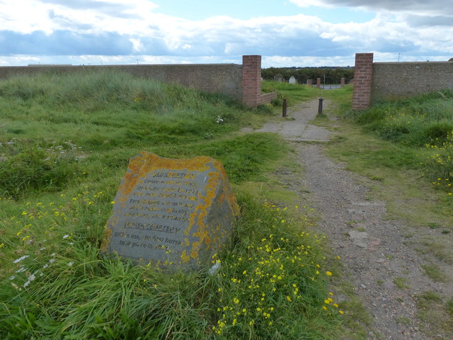
Image: © Mat Fascione Taken: 26 Aug 2017
Spion Kop Cemetery, originally known as Hartlepool Cemetery, is a disused cemetery on the coast near Hartlepool. It was opened in 1856 to replace St. Hilda's churchyard and designed by John Dobson. The area took its name from the Battle of Spion Kop in 1900 during the Boer War. The cemetery was formed from a combination of sand dune and ship's ballast. It is closed to new burials and is now managed as a local nature reserve. In the distance is the disused Steetley Magnesite pier at North Sands.
Images are licensed for reuse under creativecommons.org/licenses/by-sa/2.0
Image Location


Leaflet Map data © OpenStreetMap
Latitude
54.70752
Longitude
-1.208308