Aldbar School
Introduction
The photograph on this page of Aldbar School by Anne Burgess as part of the Geograph project.
The Geograph project started in 2005 with the aim of publishing, organising and preserving representative images for every square kilometre of Great Britain, Ireland and the Isle of Man.

There are currently over 7.5m images from over 14,400 individuals and you can help contribute to the project by visiting https://www.geograph.org.uk
Aldbar School
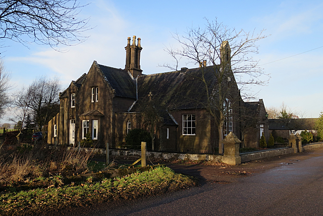
Image: © Anne Burgess Taken: 25 Jan 2018
In spite of its lancet windows and other church-like features, this was originally a school. It stands on the site of the south lodge of Aldbar Castle, and is marked on the second edition (1888-1912) of the six-inch map but not on the previous edition.
Images are licensed for reuse under creativecommons.org/licenses/by-sa/2.0
Image Location
Latitude
56.706185
Longitude
-2.694608