OS Cut Benchmark on All Saint's Primary School, Kennion Street
Introduction
The photograph on this page of OS Cut Benchmark on All Saint's Primary School, Kennion Street by Stephen Armstrong as part of the Geograph project.
The Geograph project started in 2005 with the aim of publishing, organising and preserving representative images for every square kilometre of Great Britain, Ireland and the Isle of Man.

There are currently over 7.5m images from over 14,400 individuals and you can help contribute to the project by visiting https://www.geograph.org.uk
OS Cut Benchmark on All Saint's Primary School, Kennion Street
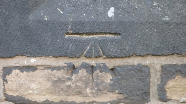
Image: © Stephen Armstrong Taken: 4 Nov 2017
This is to be found on what was No2 Kennion Street, but is now part of the school. Photographed on a Saturday afternoon, through the fence, at 20x zoom. Details of the mark at http://www.bench-marks.org.uk/bm86339
Images are licensed for reuse under creativecommons.org/licenses/by-sa/2.0
Image Location
Latitude
53.784272
Longitude
-1.763811