Pioneers Street and Grove Mill, Rochdale, Lancashire
Introduction
The photograph on this page of Pioneers Street and Grove Mill, Rochdale, Lancashire by Dr Neil Clifton as part of the Geograph project.
The Geograph project started in 2005 with the aim of publishing, organising and preserving representative images for every square kilometre of Great Britain, Ireland and the Isle of Man.

There are currently over 7.5m images from over 14,400 individuals and you can help contribute to the project by visiting https://www.geograph.org.uk
Pioneers Street and Grove Mill, Rochdale, Lancashire
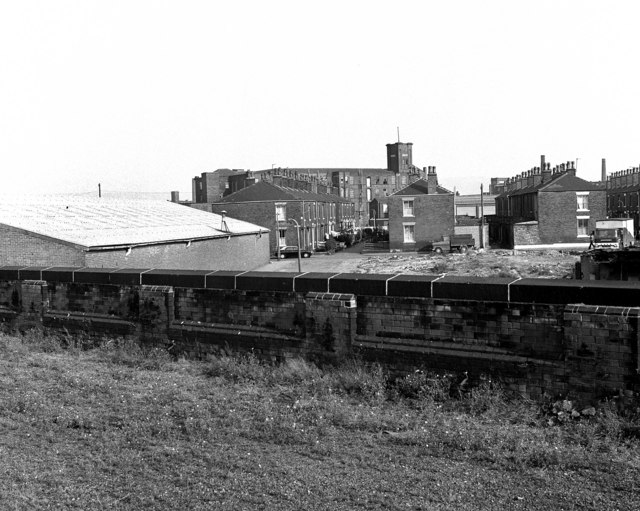
Image: © Dr Neil Clifton Taken: 15 Sep 1979
Grove Mill (cotton) is seen in the background, and the street in front of it is Pioneers Street, which was actually laid out with front gardens and only a narrow made way between them. The next street to the right is Equitable Street, laid out in the same way. The houses on the south side of Equitable Street (only just visible here) are larger than their neighbours across the road, or the ones in Pioneers Street. The two streets make T-junctions with Hare Street, running across the photo from left to right. Behind Equitable Street, the engine-house tower of Crossfield Mill (cotton waste) is just visible. The photograph was taken from the disused Up platform of Rochdale station, which has now been removed.
Images are licensed for reuse under creativecommons.org/licenses/by-sa/2.0
Image Location
Latitude
53.608962
Longitude
-2.14959