All-weather gallop near Langley Vale
Introduction
The photograph on this page of All-weather gallop near Langley Vale by Stefan Czapski as part of the Geograph project.
The Geograph project started in 2005 with the aim of publishing, organising and preserving representative images for every square kilometre of Great Britain, Ireland and the Isle of Man.

There are currently over 7.5m images from over 14,400 individuals and you can help contribute to the project by visiting https://www.geograph.org.uk
All-weather gallop near Langley Vale
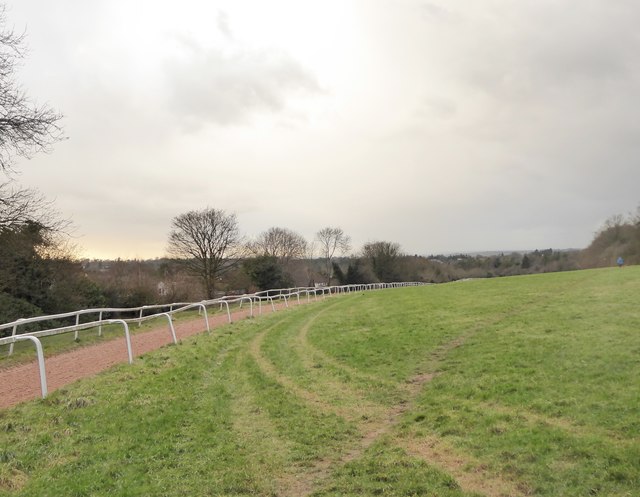
Image: © Stefan Czapski Taken: 18 Jan 2018
At a crossing-point nearby, a sign warns that between 6am and 12 noon the track is used by race-horses in training - and that they will be moving at speed. Geograph's local man-in-the-know is Hugh Craddock, and without the help of his contributions I couldn't have identified the sandy track (with guide-rails) as an 'all-weather gallop'. Apparently the surface material is 'fibresand' - which I imagine will need frequent topping up. Houses in Rosebery Road lie just down the slope to the left. Photo taken on a January afternoon, with rain on the way.
Images are licensed for reuse under creativecommons.org/licenses/by-sa/2.0
Image Location
Latitude
51.306473
Longitude
-0.259929