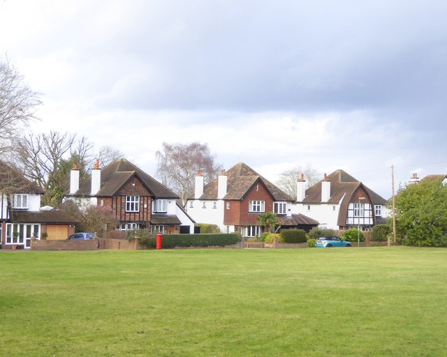
Houses by Higher Green (off Longdown Lane North)
Introduction
The photograph on this page of Houses by Higher Green (off Longdown Lane North) by Stefan Czapski as part of the Geograph project.
The Geograph project started in 2005 with the aim of publishing, organising and preserving representative images for every square kilometre of Great Britain, Ireland and the Isle of Man.
There are currently over 7.5m images from over 14,400 individuals and you can help contribute to the project by visiting https://www.geograph.org.uk

Image: © Stefan Czapski Taken: 18 Jan 2018
Quite substantial houses from the 'between-the-wars' period. While the three houses shown are basically very similar in plan, the builder has gone to some trouble to introduce a bit of variety - in the treatment of the little gabled wing that faces the street. In the house on the left this has timber framing with 'brick-nogging' as infill, while the middle house has tile-hanging - both inspired (if that's the word) by Surrey traditions. The house on the right is more eccentric - the builder has contrived what might be called a gambrel roof, though a gambrel roof normally involves one change of slope rather than two. I think I'm reminded more of Essex Image than of Surrey. The same houses appear in Hugh Craddock's Image He plainly knows the area far better than I do, and his contributions give more history.

