Steps to nameless square north of Waterville Road, Meadow Well
Introduction
The photograph on this page of Steps to nameless square north of Waterville Road, Meadow Well by Andrew Curtis as part of the Geograph project.
The Geograph project started in 2005 with the aim of publishing, organising and preserving representative images for every square kilometre of Great Britain, Ireland and the Isle of Man.

There are currently over 7.5m images from over 14,400 individuals and you can help contribute to the project by visiting https://www.geograph.org.uk
Steps to nameless square north of Waterville Road, Meadow Well
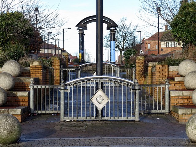
Image: © Andrew Curtis Taken: 18 Jan 2018
Formerly the junction (cross-roads) of Ripley Avenue with Waterville Road but now pedestrianised, hard-landscaped and rather bleak. The semi-circular structure of this part of the estate had been laid out by 1937 although the street names are different; for example, Ripley Avenue seems to have been Bridges Road. See here for other detail: Image, Image
Images are licensed for reuse under creativecommons.org/licenses/by-sa/2.0
Image Location
Latitude
55.002787
Longitude
-1.465933