West Monkseaton Metro Station
Introduction
The photograph on this page of West Monkseaton Metro Station by Andrew Curtis as part of the Geograph project.
The Geograph project started in 2005 with the aim of publishing, organising and preserving representative images for every square kilometre of Great Britain, Ireland and the Isle of Man.

There are currently over 7.5m images from over 14,400 individuals and you can help contribute to the project by visiting https://www.geograph.org.uk
West Monkseaton Metro Station
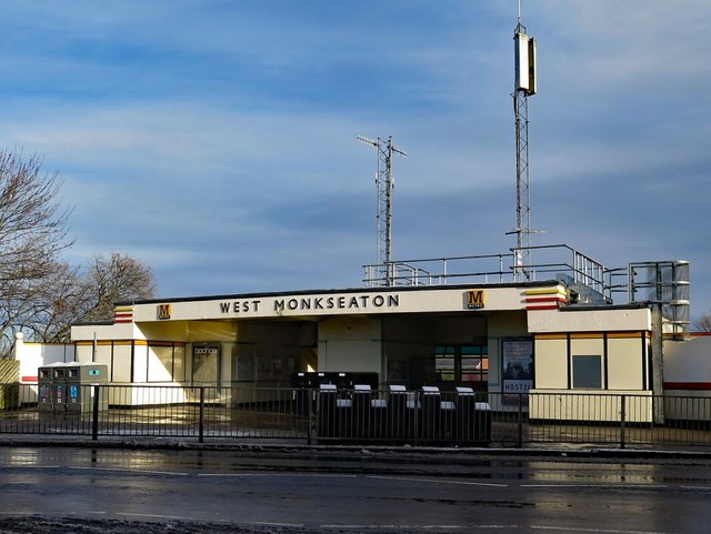
Image: © Andrew Curtis Taken: 18 Jan 2018
West Monkseaton Metro station is a station on the Yellow line of the Tyne and Wear Metro. It is located in a residential area at the west of Monkseaton, with the station entrance sited above the tracks on Earsdon Road. The reinforced concrete Art-Deco station building at street level dates from 1934 when it was a station on the London & North Eastern Railway. The station reopened on the first phase of the Tyne & Wear Metro in 1980 and the building restored in 1999. Disused Stations: http://www.disused-stations.org.uk/w/west_monkseaton/index.shtml
Images are licensed for reuse under creativecommons.org/licenses/by-sa/2.0
Image Location
Latitude
55.040216
Longitude
-1.476702